District de Cochrane
District de Cochrane.mw-parser-output .entete.map{background-image:url("//upload.wikimedia.org/wikipedia/commons/7/7a/Picto_infobox_map.png")}

| Pays | |
|---|---|
| Province | Ontario |
| Superficie | 141 237,3 km2 |
| Subdivision | Unorganized North Cochrane District |
| Coordonnées | 50° 30′ N, 83° 00′ O |

| Population | 82 503 hab. (2006) |
|---|---|
| Densité | 0,6 hab./km2 (2006) |
| Statut | District (d) |
|---|
| Fondation | 1921 |
|---|
| Indicatif téléphonique | +1 705 |
|---|
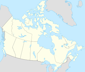
Localisation sur la carte du Canada
 |
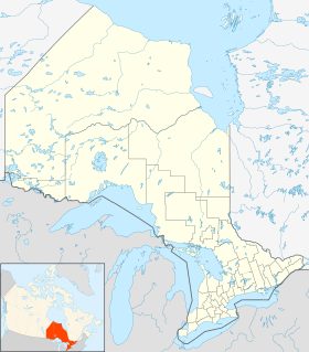
Localisation sur la carte de l’Ontario
 |
Le district de Cochrane est un district et une division de recensement du nord-est de l'Ontario. Il a été créé en 1921 à partir de parties du district de Timiskaming et du district de Thunder Bay.
En 2006, la population était de 82 503[1] habitants. Sa superficie est de 141 247,3 km2 (54 522 mi2), légèrement plus petit que l'État du Michigan. Il est le deuxième plus grand district de l'Ontario après le district de Kenora. Le centre administratif est à Cochrane.
Sommaire
1 Langue
2 Municipalités
2.1 Ville (City)
2.2 Villes (Towns)
3 Cantons (Townships)
4 Réserves indiennes
5 Territoires non organisés
6 Références
7 Liens externes
Langue |
En 2006, près de 47 % de la population avait le français pour langue maternelle contre presque 45 % pour l'anglais[1].
Municipalités |
Ville (City) |
- Timmins
Villes (Towns) |
- Cochrane
- Hearst
- Iroquois Falls
- Kapuskasing
- Moosonee
- Smooth Rock Falls
Cantons (Townships) |
- Black River-Matheson
- Fauquier-Strickland
- Mattice-Val Côté
- Moonbeam
- Opasatika
- Val Rita-Harty
Réserves indiennes |
- Abitibi 70
- Constance Lake 92
- Factory Island 1
- Flying Post 73
- Fort Albany 67
Moose Factory 68- New Post 69
- New Post 69A
Territoires non organisés |
- Cochrane, territoire non organisé, partie nord
- Cochrane, territoire non organisé, partie sud-est
- Cochrane, territoire non organisé, partie sud-ouest
Références |
Statistique Canada : Recensement 2006 : Cochrane (district)
Liens externes |
- Ressource relative à la géographie : GeoNames
 Portail des Franco-Ontariens
  Portail du Canada
  Portail de l’Ontario


